Download KML Manager
A short introduction to KML an GPX
Keyhole Markup Language (KML) and GPS Exchange Format (GPX) are two widely used file formats in the field of geospatial data, each serving distinct purposes in the realm of mapping and location-based services.
KML, developed by Keyhole Inc. and later acquired by Google, is an XML-based format used to represent geographic information in three dimensions. It is commonly employed for creating maps in applications like Google Earth. KML files contain data about points, lines, polygons, and images, allowing for the visualization of spatial information along with attributes such as names, descriptions, and styles. Users can define placemarks, paths, and polygons, enhancing the interactive and visual aspects of geographic data representation.
On the other hand, GPX, the GPS Exchange Format, is a standard XML-based file format designed for the interchange of GPS data between devices and applications. Originally developed by TopoGrafix, GPX has become a universal format compatible with various GPS receivers and mapping software. GPX files store waypoints, tracks, and routes, providing a standardized way to share location information. This format is particularly valuable for outdoor enthusiasts, such as hikers and cyclists, who use GPS devices to track their journeys and share routes with others.
While KML focuses on the visual representation of geographic data with an emphasis on 3D visualization, GPX is more geared towards the exchange of GPS-related information. The two formats are not mutually exclusive, and there are tools and applications that can convert data between KML and GPX, enabling interoperability. This interoperability is especially useful for individuals and organizations that need to work with geographic data across different platforms and applications.
In conclusion, KML and GPX are essential file formats in the world of geospatial data, each serving specific purposes. KML excels in visualizing spatial information in applications like Google Earth, while GPX facilitates the exchange of GPS data between devices and applications, catering to the needs of outdoor enthusiasts and professionals alike. The compatibility and interoperability between these formats contribute to their widespread adoption in diverse fields involving geographic information systems and location-based services.
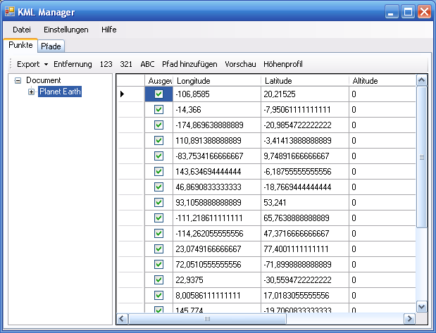
KML Manager is a tool for transforming the following GPS file formats
- KML 2.1 (read and write)
- KML 2.0 (read)
- KMZ (read)
- GPX 1.1 (read and write)
- GPX 1.0 (read)
- JOSM (Openstreetmap Editor) OSM XML (write)
- CSV (read and write)
- OVL ASCII (read and write)
- ASC (TomTom, read and write)
- ITN (TomTom, read and write)
- OV2 (TomTom, write)
- XML (write)
- OSM (read)
- NMEA logfile (GPS Daten, read)
- Geocaching (read)
- PTH (MagicMaps, read and write)
- TK (Kompass Alpenverein, read)
- PLT (OziExplorer Tracks, read)
- BCR (Motorrad Routenplaner (Map&Guide), read)
- WPT (PCX5 Garmin Waypoints, read)
- Garmin POI Loader CSV (write)
- Garmin Course TCX (read)
- Nokia Maps POIs (lmx, write)
- Osmosis Polygone (*.txt, write)
- Trackspace (*.tsf, read)

I do not ensure that the above mentioned GPS file formats are compatible to any third party software or to any third party equipment. I do not ensure that the above mentioned GPS file formats are fully implemented in all of theirs complexity. It is up to you to check if the KML Manager fits your needs.
Payment with Paypal. Please click at the Buy Now Button to proceed. I will send you the license key via email. This can take up to one or two working days.